


SPC MD 811
MD 0811 CONCERNING SEVERE THUNDERSTORM WATCH 252... FOR COASTAL PARTS OF ALABAMA AND THE FLORIDA PANHANDLE
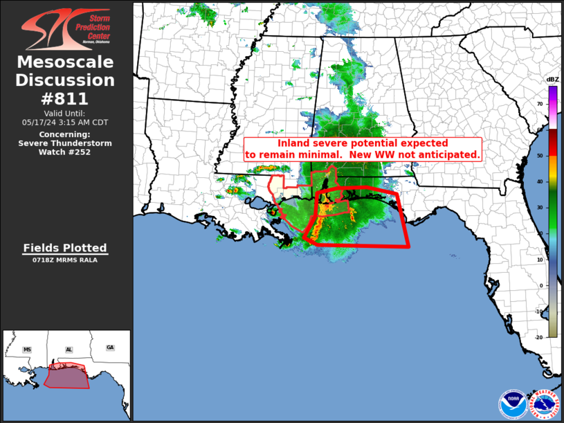
Mesoscale Discussion 0811
NWS Storm Prediction Center Norman OK
0221 AM CDT Fri May 17 2024

Areas affected...coastal parts of Alabama and the Florida Panhandle

Concerning...Severe Thunderstorm Watch 252...

Valid 170721Z - 170815Z

The severe weather threat for Severe Thunderstorm Watch 252
continues.

SUMMARY...Severe threat has moved primarily offshore, with inland
potential limited largely to coastal counties.  As such, downstream
WW is not anticipated.

DISCUSSION...Latest radar loop shows an overall, gradual decrease in
organization of the bowing MCS which has now fully cleared far
southeastern Louisiana, such that the bulk of the strongest
convection is now offshore.

Instability -- as indicated by RAP-based objective analysis --
remains essentially non-existent inland, with the gradient lying
across coastal counties of Alabama and the Florida Panhandle.  With
this expected to remain the case over the next few hours, it appears
unlikely that any substantial increase in risk will occur farther
inland.  As such, with threat so confined areally, downstream WW
issuance -- beyond the scheduled 17/08Z expiration of Tornado Watch
252 -- is not anticipated.

..Goss.. 05/17/2024

...Please see www.spc.noaa.gov for graphic product...

ATTN...WFO...TAE...MOB...

LAT...LON   29248863 29858827 30528822 30678756 30708660 30498561
            28988525 29048819 29248863
Read more